 6
6NASA’s Perseverance rover, China’s Tianwen 1, and the United Arab Emirates’ Hope orbiter share their latest photos from Mars.
Now that three missions have arrived at Mars, we're seeing many first returns, including images that highlight the Red Planet's beauty from outside and within.
Tianwen 1's Images Mars in High-def
China's Tianwen 1 spacecraft is gradually activating its seven instruments, including a color camera that shot the image of Mars's north pole.

CNSA
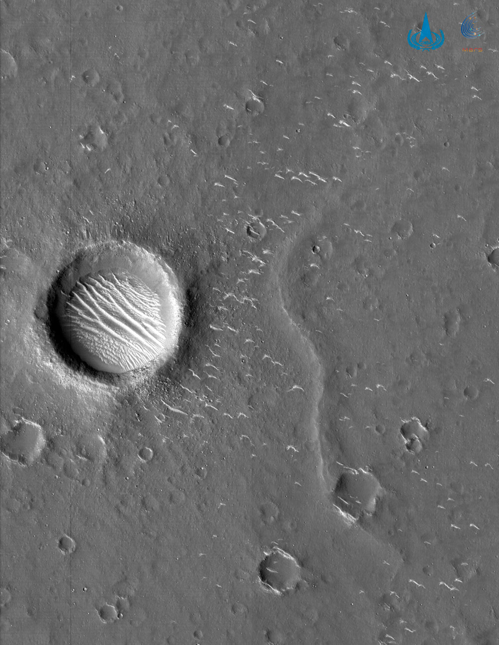
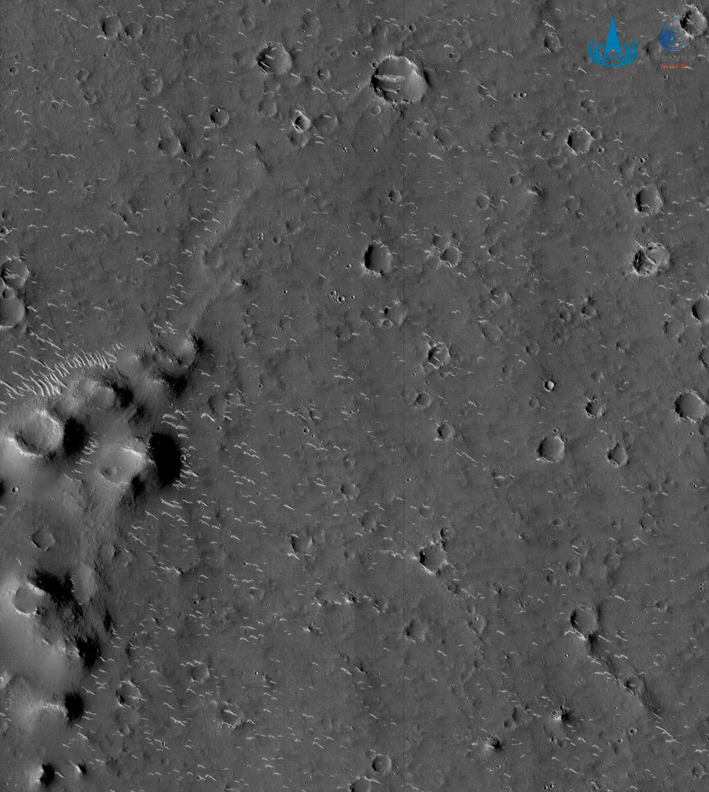
Two additional black-and-white images were shot from a different camera. Unlike the color shot, these are in high-def, resolving features just 7 meters (23 feet) across.
While the China National Space Association did not specify which location the black-and-white camera had imaged, the organization did release a statement saying that the orbiter is mapping the southern region of Utopia Planitia and investigating its weather patterns. The mission is scouting out a landing site for the still-unnamed rover carried on Tianwen 1. The 240-kg, solar powered rover is set to explore its landing site for about three months following its landing, expected in May or June.
CNSA
CNSA
Hope's View from Orbit
Meanwhile, the United Arab Emirates' Hope probe has already returned hundreds of images from its wide orbit around Mars, though they're not all publicly available. The latest was released on Tuesday:

Emirates Mars Mission / EXI
Perseverance Flexes Its Arm — and Zoom-in Cameras
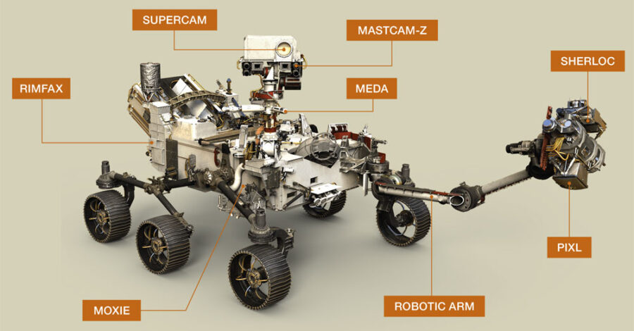
Meanwhile, NASA's Perseverance rover is in the midst of checking out its instruments one at a time, collecting amazing imagery along the way.
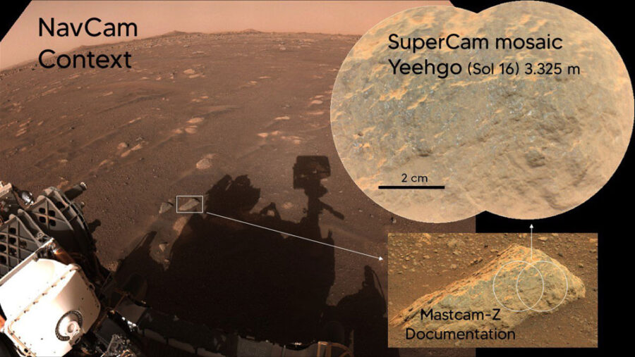
Among the instruments undergoing health checks is SuperCam, a "Swiss Army knife" of five instruments mounted on the rover's head. The remote-sensing suite includes a rock-zapping laser; three types of spectroscopic instruments, which investigate rocks' minerals and molecular structure and directly search for organic materials; and the Remote Micro-Imager (RMI) based on the ChemCam aboard Curioisty but now in color.
NASA / JPL-Caltech
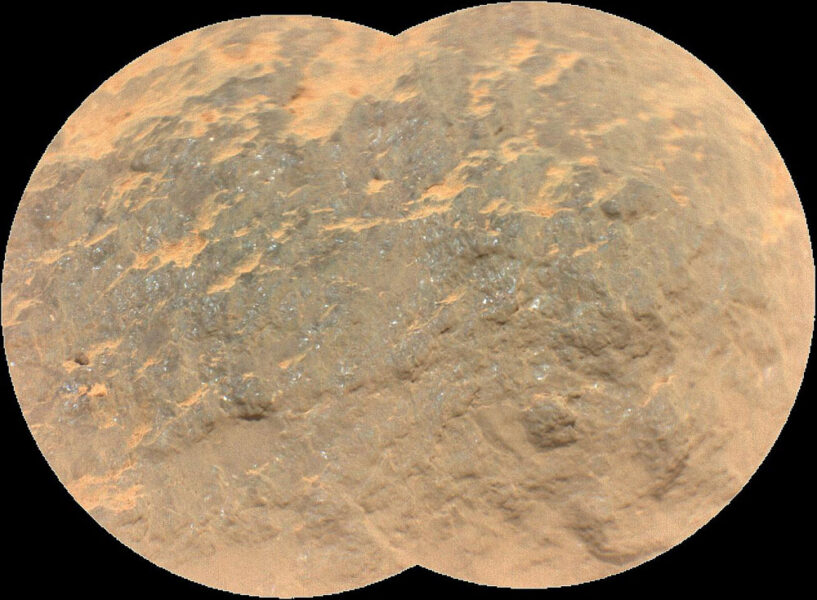
Without the need to position the rover or its robotic arm, the RMI can take images quickly from afar. Among the first targets for analysis are rocks dubbed Maaz and Yeehgo. (These are alternative spellings of Máaz and Yéigo, Navajo words meaning "Mars" and "diligent.") The terms provide a common nomenclature for the mission team, and they come from collaboration between NASA and the Navajo Nation's administration.
NASA / JPL-Caltech / LANL / CNES / CNRS / ASU / MSSS
NASA / JPL-Caltech / LANL / CNES / CNRS / ASU / MSSS
NASA / JPL-Caltech / LANL / CNES / CNRS
NASA also just released another take on the second half of Perseverance's "seven minutes of terror," this time shown from the viewpoint of the cameras involved in the terrain-relative navigation technique:
You’re looking at the real deal images I used to make my pinpoint landing. This is how I quickly got my bearings and picked the safest target in the last three minutes before touchdown. How it works: https://t.co/Q1dBl8ZH8x pic.twitter.com/HK6uuKbLcQ
— NASA's Perseverance Mars Rover (@NASAPersevere) March 11, 2021
Finally, if you haven't had your fill of Mars just yet, check out this amazing 360-degree panorama shot by Perseverance's Mastcam-Z:
About Monica Young
Monica Young, a professional astronomer by training, is News Editor of Sky & Telescope.


Comments
Andrew James
March 11, 2021 at 4:35 pm
"You’re looking at the real deal images I used to make my pinpoint landing. This is how I quickly got my bearings and picked the safest target in the last three minutes before touchdown."
Is Perseverance alive, or is NASA aiming for the 3-5 year old audience?
You must be logged in to post a comment.
Peter Wilson
March 11, 2021 at 6:22 pm
The twitter feed is aimed at...twitter followers.
You must be logged in to post a comment.
Andrew James
March 12, 2021 at 1:14 am
That there explains it! 🙂
You must be logged in to post a comment.
New Jersey Eclipse Fan
March 15, 2021 at 4:34 pm
And for the rest of us, there's Google (which can often give us access to Twitter entries anyway). Ha! Who needs social media anyway?
You must be logged in to post a comment.
Dobsonite
March 13, 2021 at 1:04 am
Those streaks at the bottom of that crater pic taken by the Chinese probe are _very_ interesting. Seeing that the crater must be hundreds of feet deep, what could they be? Sand? Frozen water? The walls of the crater on the left look like they have dark areas that might be holes? Love to set down in there and check it out!
You must be logged in to post a comment.
Yaron Sheffer
March 26, 2021 at 5:47 pm
My wager is that we are looking at sand dunes. They are all over the landscape outside the crater, too. There may be deeper sand trapped inside the crater, so it looks more prominent. Anyway, will be waiting for your report after you land there 🙂
You must be logged in to post a comment.
You must be logged in to post a comment.