 4
4Using Earth as an example, astronomers are testing a new technique that could image rocky exoplanets without resolving them.
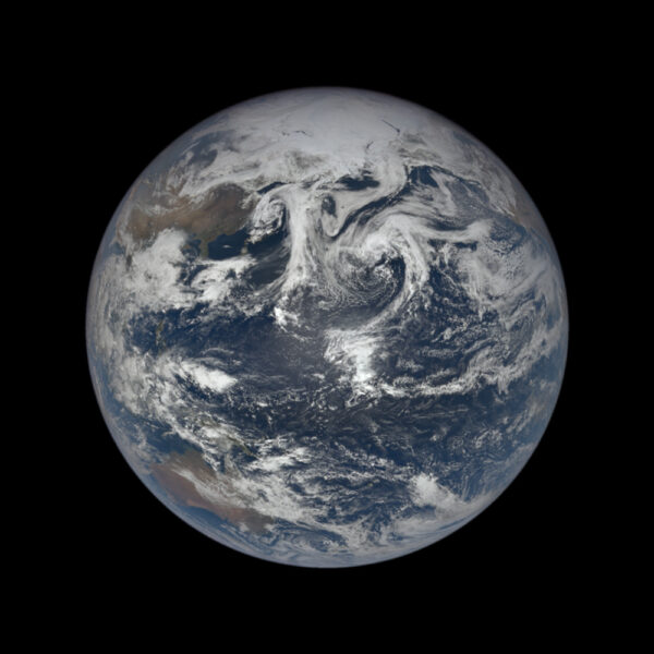
NASA EPIC Team
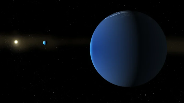
Astronomers can directly image exoplanets, a feat in and of itself. But under certain circumstances, a new technique might enable us for the first time to reveal details on a planet’s surface.
Ordinarily, light from a star washes out the reflected light of any exoplanets in orbit around it. So current direct images are of large exoplanets in far-out orbits that are very young. These worlds’ can be imaged because they are still glowing with the heat of formation. But such images don't reveal surface details.
Soon, though, improvements in imaging technology might make it possible to determine with just a few pixels if a terrestrial exoplanet has oceans and continents, Atsuki Kuwata (University of Tokyo) argues. The proof of concept will appear in Astrophysical Journal (preprint available here).
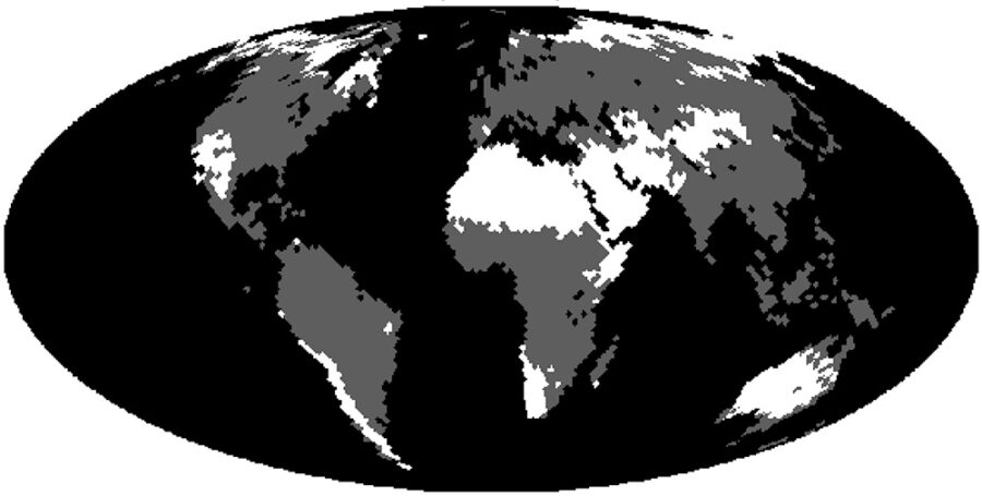
Kuwata et al. / Astrophysical Journal 2022
The key, Kuwata says, is not to fully resolve the surface but to collect data as the world turns. The variations in brightness can reveal surface contrasts. “A two-dimensional surface distribution can be decoded from the diurnal and seasonal variations in reflected light,” Kuwata explains.
Kuwata and his team applied their technique to data from the DSCOVR Earth-observing satellite. Its camera, EPIC, provides detailed measurements of ozone, aerosols, cloud reflectivity, cloud height, vegetation properties, and UV radiation estimates at the Earth's surface.
The researchers first cleaned the images, removing as many of the clouds as they could, then they “dumbed down” the detailed data so that our world appeared as a distant exoplanet. Then they applied their analysis, revealing patterns that they identified as oceans and cloud cover. They also found two components that they identified as land.
“One of the [land] components captured is the Sahara Desert,” Kuwata explains, “and the other roughly corresponds to vegetation, although their spectra are still contaminated by clouds."
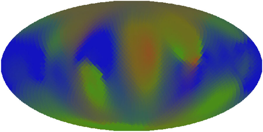
Kuwata et al. / Astrophysical Journal 2022
Kuwata cautions that this method will only work on rocky surfaces. “Since this study assumes static components, such as continents, we cannot apply directly to dynamic ones, such as gas [giants],” he says.
There are also limits of time and distance for the technique the team developed. For starters, they need to observe the full planet’s surface over the course of both its day and year in order to disentangle spin and orbital rotation.
“Roughly speaking, we need to spend several days per month over a year’s observation using an 8-meter telescope with a perfect coronagraph, for an Earth analog at 16 light-years,” says team member Hajime Kawahara (University of Tokyo).
Determining the surfaces of terrestrial exo-planets using the technique developed by Kuwata and his team will depend on the quality of the data collected, says Timothy Brandt (University of California). “A technique similar (to Kuwata’s) has already been used to map temperature variations on a tidally-locked hot-Jupiter (HD 189733),” Brandt says.
NASA plans to fly a 6-meter space telescope by the 2030s, which will enable direct imaging of about two-dozen nearby Earth-like planets. That data will likely be amenable to this new technique. “For exoplanets 1,000 light-years away, larger space telescopes are required,” Kawahara says.


Comments
iborg
May 13, 2022 at 5:58 pm
Hi
Bearing in mind the first image above, of "A recent DSCOVR view of Earth centered on the Atlantic Ocean." As I live in Australia, I'm curious about when I was moved to the Atlantic Ocean? The Korean's reading this might also like know!
Philip
You must be logged in to post a comment.
Monica Young
May 14, 2022 at 4:24 pm
Apologies to Australians and Koreans alike for the editorial error! I've fixed the caption.
You must be logged in to post a comment.
Robert-Casey
June 1, 2022 at 4:06 pm
Imagine if the Sun's planets were named the same way we do exoplanets.
Venus, being the brightest, would be Sun b
A tossup between Jupiter and Mars (Mars moves faster, but Jupiter is brighter)
Jupiter would be Sun c
Mars sun d
Saturn would be Sun e
Mercury, being usually obscured by twilight dusk and dawn, would be Sun f
It took a while for people to realize that the Earth is a planet, around the time of Tycho and Copernicus, so teh Earth would be Sun g.
Uranus is Sun h
Neptune Sun i
You must be logged in to post a comment.
Robert-Casey
June 1, 2022 at 4:11 pm
The sequence I used above is the likely the order Man would have identified each of the Sun's planets. Just like the way we name exoplanets, the first one of a star's is b, 2nd c and so on.
You must be logged in to post a comment.
You must be logged in to post a comment.